
The hidden military lineage of Southeast Asia’s most resilient supply chain.
At 3,505 meters long, engineers built U-Tapao’s runway to launch fully loaded military aircraft into a regional war zone. Today, that same strip of concrete handles civilian jets, charter flights, and cargo operations—clear evidence that Thailand quietly repurposed wartime infrastructure into a commercial backbone.
This adaptive mindset extends beyond visa policy. For example, in the post-Ukraine period, Thailand expanded visa-exemption schemes that allowed Russian passport holders to stay up to 90 days, explicitly aiming to sustain tourism inflows during geopolitical disruption. Royal Thai Ministry of Foreign Affairs: Visa exemption announcement (Oct 2023) Meanwhile, Thailand continues to refine its digital-asset regulatory framework and pilot initiatives like the TouristDigiPay program. In effect, the pilot aims to let foreign visitors convert cryptocurrencies into Thai baht under supervised conditions—further integrating modern capital tools into the tourism economy. TouristDigiPay pilot overview
Most people explain Thailand’s post‑Vietnam boom with culture: food, beaches, affordability. However, the infrastructure story is less famous—and more decisive. Beneath the neon sat a logistics network built for war: runways, aprons, fuel farms, navigation aids, and the legal steps that later turned them into civilian gateways for tourists and freight.
At a glance
- Claim: Thailand’s postwar tourism scale is partly an infrastructure reuse story, not just a cultural one.
- Evidence: seven U.S.-era bases, documented conversion steps (especially U-Tapao), and Eastern Seaboard port build-out (Laem Chabang).
- Why it matters: this lineage helps explain why Thailand can absorb tourism surges while keeping freight moving.
Jump to a section
- The $50B number and what it captures
- The seven bases were never “just bases”
- U-Tapao’s conversion is documented
- “Military-grade” is measurable
- How the Vietnam-era air bridge seeded tourism
- Laem Chabang and the Eastern Seaboard corridor
- The infrastructure lineage behind modern shipping outcomes
The $50B number and what it captures
By 2019, Thailand’s tourism engine was generating about 1.93 trillion baht in revenue—roughly $53 billion. Bangkok Post: 2019 tourism arrivals and revenue context AP: Thailand tourism scale context
The widely told version of how Thailand got there is cultural: food, beaches, affordability. The less-told version is infrastructural—and it starts with seven American-era air bases.
The seven bases were never “just bases”
During the Vietnam War era, the United States operated from multiple Royal Thai air bases. A Library of Congress analysis of U.S. installations points to key USAF operating bases including Takhli, Korat, Ubon, U-Tapao, Don Muang, and Udorn. Library of Congress: U.S. bases in Thailand during the Vietnam War
A seventh node—Nakhon Phanom—played a significant role in irregular warfare and operations along the Ho Chi Minh Trail, as described in U.S. Navy historical material. U.S. Navy History: Nakhon Phanom
This matters because the “Thailand tourism miracle” wasn’t built on vibes. It was built on a wartime requirement: move aircraft, people, parts, and fuel—with reliability. Nowhere is that clearer than U-Tapao.
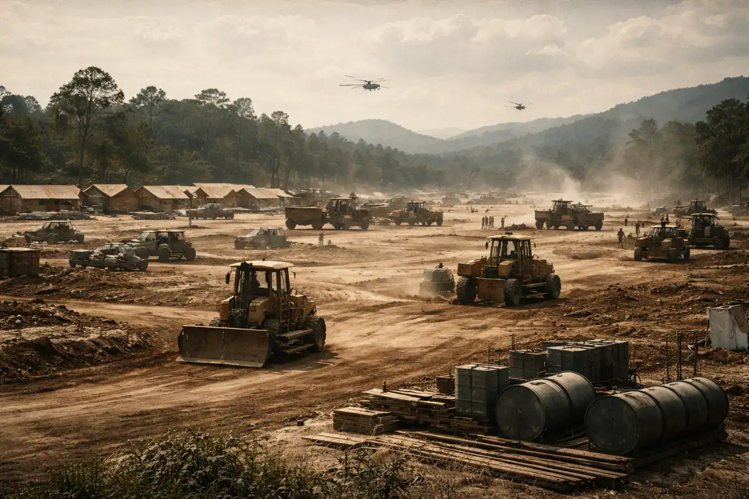
1960s: Runways built for wartime tempo would later anchor Thailand’s civilian aviation and tourism expansion.
U-Tapao’s conversion is documented, not mythical
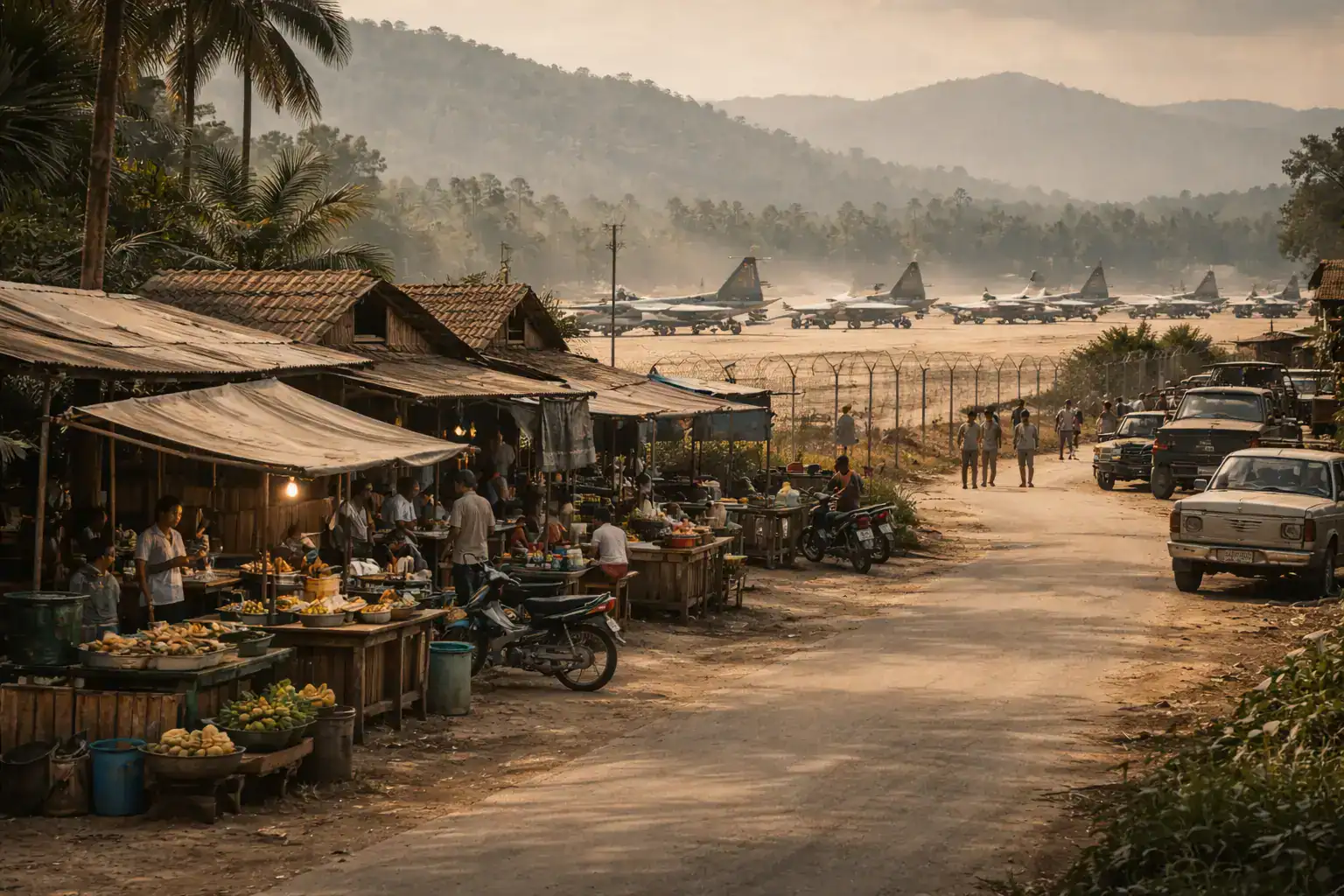
U-Tapao International Airport sits roughly 30 kilometers south of Pattaya and around 35 kilometers west of Rayong city, according to an Environmental and Health Impact Assessment (EHIA) chapter hosted by the Asian Infrastructure Investment Bank (AIIB). AIIB: EHIA Chapter 1 (U-Tapao location and context)
The same EHIA chapter lays out a direct lineage that most logistics content never mentions. U-Tapao was first built as a naval air base with a 1,200-meter asphalt runway, later expanded after a 1965 Thai Cabinet resolution tied to regional conflict dynamics.
After U.S. withdrawal, Thailand decided in 1976 to convert U-Tapao into a secondary international commercial airport complementing Don Muang—and issued Ministerial Regulation No. 68 (1976) under the Customs Act, designating it as a customs airport to handle international commercial flights and serve as an import-export hub. AIIB: EHIA Chapter 1 (1976 conversion and customs-airport designation)
Operationally, the Thai Cabinet later approved joint operation with the Department of Commercial Aviation (1989), with responsibilities split between Royal Thai Navy functions and civil aviation functions.
Thailand’s own government tourism and investment channel describes the U-Tapao development plan as including cargo-linked components such as a Cargo Village, Free Trade Zone, and a Cargo Complex. Thailand.go.th: U-Tapao development plan (cargo components)
“Military-grade” is measurable: runway length, apron scale, design criteria
If you want evidence that the infrastructure was built to move heavy metal—and still can—the specs do the talking. The AIIB EHIA chapter states U-Tapao’s current runway is an ICAO code 4E runway and measures 3,505 meters by 60 meters, with Instrument Landing System (ILS) Precision CAT I described for runway operations. AIIB: EHIA Chapter 1 (runway class, dimensions, ILS)
U-Tapao’s published airport data lists the same runway length and width and adds an operational detail freight operators care about: apron area and stand counts. It lists an apron size of 432,300 square meters and multiple aircraft stands across apron zones. U-Tapao Airport: runway and apron data
This is the physical substrate that lets a country do two things at once: scale tourism flows and keep freight moving, even when demand surges are lumpy.
The Vietnam-era air bridge helped seed the tourism product
Tourism didn’t grow out of nowhere. It grew with demand that was, at first, institutional. During the Vietnam War, Bangkok was a common destination for R&R leave for personnel serving in Vietnam, according to New Zealand’s official Vietnam War history site. Vietnam War (NZ Govt): R&R context
Economists and historians have tracked how that war-linked demand accelerated Bangkok’s service economy. A widely cited academic paper on Bangkok’s development argues that U.S. military involvement influenced the city’s growth through base construction and related infrastructure and through spending by servicemen on leave, alongside the first major upswing in tourism. TAT Tourism Library: Bangkok development paper (full text)
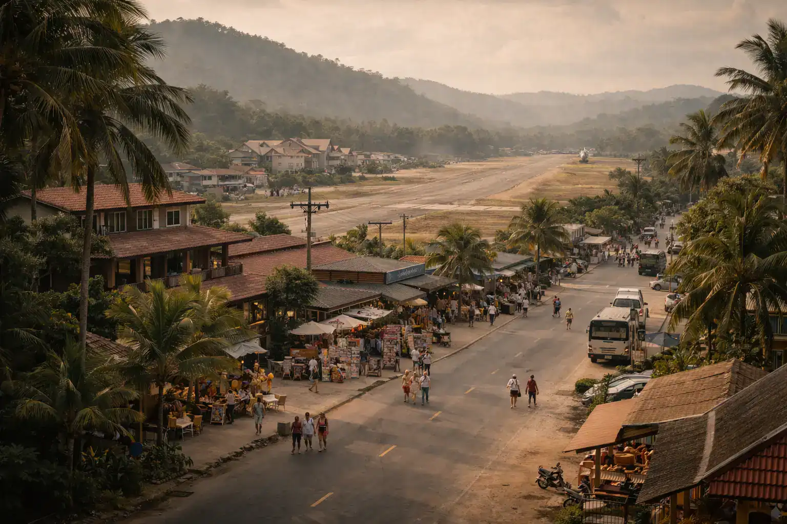
Pattaya—now a global brand—was, according to standard historical summaries, a fishing village until the 1960s, with tourism beginning during the Vietnam War as American servicemen arrived on R&R. Wikipedia: Pattaya overview
1970s: War-linked air traffic created demand that accelerated Thailand’s early tourism and service sectors.
Laem Chabang and the Eastern Seaboard turned the war coastline into a container corridor
If U-Tapao is the aviation keystone, Laem Chabang is the maritime sequel. Thailand’s Port Authority history states that the Sattahip port, formerly a Navy port, was developed for commercial use under PAT management in 1979; that construction of Laem Chabang Port started in 1987; and that it was officially opened on 21 January 1991. Port Authority of Thailand: history
That same PAT history notes that by 1997, Laem Chabang hit 1 million TEU and became Thailand’s major port, triggering Phase 2 acceleration. Port Authority of Thailand: Laem Chabang throughput milestone
The Japan Society of Civil Engineers’ Laem Chabang project page describes a construction project started in 1987, based on a JICA master plan presented in 1985, and emphasizes that roads and railroads were developed in parallel with port development. JSCE: Laem Chabang project archive
JICA’s evaluation summary frames the Eastern Seaboard Development Plan as a major infrastructure program centered on Laem Chabang and Map Ta Phut, explicitly including related infrastructure such as ports, roads, rail, and the development of industrial estates. JICA: Eastern Seaboard Development Plan evaluation summary
A JICA ex-post evaluation summary compares container handling productivity per crane—28 pieces/hour at Laem Chabang vs 20 pieces/hour at Bangkok Port. JICA: productivity comparison (ex-post evaluation)
Together, those documents sketch a coherent transformation: a Gulf-of-Thailand coastline once valued for strategic basing becomes a paired system—aviation capacity (U-Tapao) plus deep-sea container throughput (Laem Chabang)—supported by industrial estates and transport links.
1980s–1990s: Military airfields and coastal bases were folded into the Eastern Seaboard corridor and tourism growth strategy.
The hidden infrastructure lineage behind modern shipping outcomes
This is where most logistics competitors stop at generic claims like “Thailand has good infrastructure.” The lineage is the reason. You can trace it in documents.
Vietnam-era air operations pushed heavy use of Thai bases; official USAF history describes tanker operations at U-Tapao beginning in 1966, and notes Don Muang reconnaissance deployments in 1961. USAF history (archived): U-Tapao tanker ops and Don Muang deployments
Declassified Project CHECO reporting shows the Air Force treated Thailand base defense as a serious operational domain—evidence of the security and operational rigor associated with these sites. Project CHECO (archived): Thailand base defense reporting
Postwar Thailand then reorganized key nodes as dual-use, with U-Tapao explicitly designated a customs airport and import-export hub, and later planned as an aerotropolis with cargo components. AIIB: EHIA Chapter 1 (customs airport and hub) Thailand.go.th: cargo-linked components
For maritime freight, PAT and JICA documentation show a deliberate shift from constrained river port capacity toward deep-sea container throughput at Laem Chabang, with measurable productivity differences and a planning lineage rooted in the Eastern Seaboard program. Port Authority of Thailand: Laem Chabang development timeline JICA: container handling productivity comparison
At SwiftCargo, our internal household-goods shipment data shows 94% clear Thai customs within 48 hours (internal SwiftCargo measurement; methodology available on request). This infrastructure lineage helps explain why that speed is achievable here—while many civilian-built ports struggle to replicate it at scale.
If you want the practical takeaways for shipping into Thailand—including which entry points are typically fastest for different household-goods profiles—see our Thailand port expertise section
The takeaway: Thailand didn’t just “get tourism.” It engineered reuse.
Thailand’s Vietnam War legacy isn’t only cultural. It’s operational.
- Seven bases built to support wartime tempo became a nationwide mobility mesh.
- U-Tapao’s conversion is documented down to a customs-airport regulation and cabinet decisions.
- Laem Chabang’s rise is documented as part of a deliberate corridor plan, backed by productivity metrics.
You don’t have to romanticize any of this history to recognize the outcome: infrastructure that can absorb shocks—tourism surges, freight spikes, rerouted capacity when Bangkok saturates—and keep moving. That’s not an accident. It’s a conversion strategy.
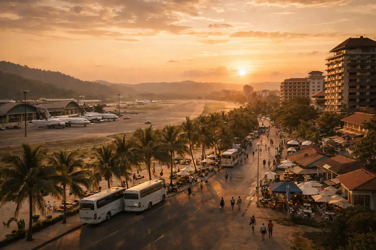
Today: The same runway network once designed for military operations now supports Thailand’s $50B tourism economy and regional freight flows.
Frequently Asked Questions
How many U.S. military bases operated in Thailand during the Vietnam War?
Seven major U.S.-operated air bases functioned in Thailand during the Vietnam War era.
Historical documentation from the Library of Congress and U.S. military archives identifies U-Tapao, Takhli, Korat, Ubon, Udorn, Don Muang, and Nakhon Phanom as key operational nodes. These were not temporary landing strips; they were fully developed airfields with fuel farms, navigation systems, and heavy-aircraft capability—foundations later reused for civilian aviation.
Was U-Tapao originally built as a civilian airport?
No. U-Tapao was built as a naval air base in the 1960s.
According to the AIIB-hosted EHIA documentation, U-Tapao began as a 1,200-meter naval runway and was later expanded during the Vietnam War. In 1976, Thailand formally converted it into a commercial airport under Ministerial Regulation No. 68, designating it as a customs airport—an explicit legal pivot from military to trade infrastructure.
How did Vietnam War infrastructure contribute to Thailand’s tourism boom?
Military runway capacity and R&R traffic seeded Thailand’s early tourism ecosystem.
R&R programs brought servicemen into Bangkok and Pattaya, accelerating hotel, restaurant, and entertainment growth. Academic research in the TAT Tourism Library notes how U.S. military spending influenced Bangkok’s service sector expansion, while runway infrastructure later enabled mass civilian aviation.
What makes U-Tapao strategically important today?
Its 3,505-meter ICAO 4E runway supports both heavy passenger jets and cargo aircraft.
Official airport data confirms runway dimensions of 3,505 x 60 meters and significant apron capacity (432,300 sqm). This scale allows U-Tapao to absorb overflow traffic from Bangkok and operate as a cargo-capable customs gateway.
What is the Eastern Seaboard Development Plan?
A large-scale infrastructure program that transformed Thailand’s Gulf coastline into a logistics corridor.
JICA and Port Authority documentation show Laem Chabang Port, Map Ta Phut, industrial estates, and transport links were deliberately developed beginning in the 1980s. This integrated corridor tied former strategic coastline to container throughput and export-driven growth.
Why did Laem Chabang replace Bangkok Port as Thailand’s primary container hub?
Capacity and productivity.
JICA ex-post evaluations report crane productivity of 28 moves per hour at Laem Chabang versus 20 at Bangkok Port. Deep-sea capability also removed river-draft constraints that limited expansion.
Did Thailand intentionally reuse military infrastructure for economic growth?
Yes, through documented cabinet resolutions and regulatory conversion.
Thai Cabinet decisions in 1976 and 1989 formalized U-Tapao’s commercial role. Rather than abandon assets, Thailand layered civilian aviation, customs designation, and later aerotropolis planning onto existing military-grade foundations.
How does this infrastructure lineage affect modern freight and customs speed?
High-capacity infrastructure reduces congestion risk.
Airports and ports designed for wartime tempo were built for surge resilience. This makes it structurally easier to maintain clearance speed, particularly at nodes like U-Tapao and Laem Chabang compared to ports originally built for lighter civilian throughput.
Was Pattaya always a tourism hub?
No. It was a fishing village prior to the 1960s.
Historical summaries attribute Pattaya’s early tourism growth to Vietnam-era R&R demand. Its proximity to U-Tapao accelerated hospitality investment and later beachfront development.
Is Thailand’s $50B tourism industry purely cultural?
Culture matters—but infrastructure scale enabled mass tourism.
Tourism revenue reached approximately 1.93 trillion baht in 2019. While cultural appeal drives demand, the physical ability to process millions of arrivals annually depends on runway length, customs designation, port throughput, and coordinated corridor planning.
Additional background (general references): Wikipedia: U-Tapao International Airport Wikipedia: USAF in Thailand Wikipedia: Thailand in the Vietnam War
For duty-free clearance within 48 hours and expert handling of Thailand shipping timelines, visit our Thailand shipping services page.